Tuesday, April 2, 2019

Understanding Katla Volcano in Iceland

Recent seismic activity in the region of Katla has led researchers to believe it will erupt again. In order to understand the potential hazards of new eruptions, researchers need to understand how these eruptions historically behaved. In their new paper titled Large Explosive Basaltic Eruptions at Katla volcano, Iceland: Fragmentation, grain size and eruption dynamics, Schmith et al. (2018) investigated why this volcano is so explosive. In order to do this, they used size, shape, and composition of the ash fall deposits from the eruptions in the 17th and 18th century.

Katla, one of most hazardous volcanoes in Iceland, is located in the southeastern part of the country (Fig. 1 & 2). The volcano lies 1450 m above sea level, and the caldera covers an area of nearly 110 km2. Katla is topped by the 230 m thick Mýrdalsjökull glacier which covers an area of ~ 600 km2, which melts and causes lahars and flooding during eruptions. Katla has a history of major explosive eruptions that occur on average about every 50 years. These eruptions are sometimes large enough that ash falls on mainland Europe, including during the 1625 and 1755 CE eruptions.

The 2010 Eyjafjallajökull eruption in Iceland was small compared to past eruptions of Katla, yet airspace in 20 countries was closed for 5 days to commercial air traffic, ~ 10 million travelers were affected, and the world’s average temperature fell by 1 ℃. A future Katla eruption is predicted to be ten times larger than the 2010 Eyjafjallajökull eruption. Heat from Katla causes glacial outburst floods when parts of the Mýrdalsjökull glacier melt and breach the crater of the volcano creating large lahars. During the last major eruption of Katla in 1918, the lahar produced was so large that it extended Iceland’s coastline in the region by 5 km (Katla’s Hazards, 2019).

Figure 1: A: Iceland with the region of interest shown in the red box. B: Zoomed in view of the region of interest showing locations of the Eyjafjallajökull, Katla, and Surtsey volcanoes in southeastern Iceland. Satellite imagery courtesy of Google Earth.

In order to understand the mechanisms of past eruptions and the extent of magma/water interactions, the researchers first turned to ash deposits. They evaluated the amounts of tachylite (heterogeneous glass), sideromelane (homogeneous glass), lithics (rock pieces), or crystals. By understanding the amounts of each of these are present in the ashfall, scientists can infer whether the explosivity of an eruption is more fragmentation/gas dissolution driven or driven by interaction of water and magma to cause explosive steam and lava eruptions.

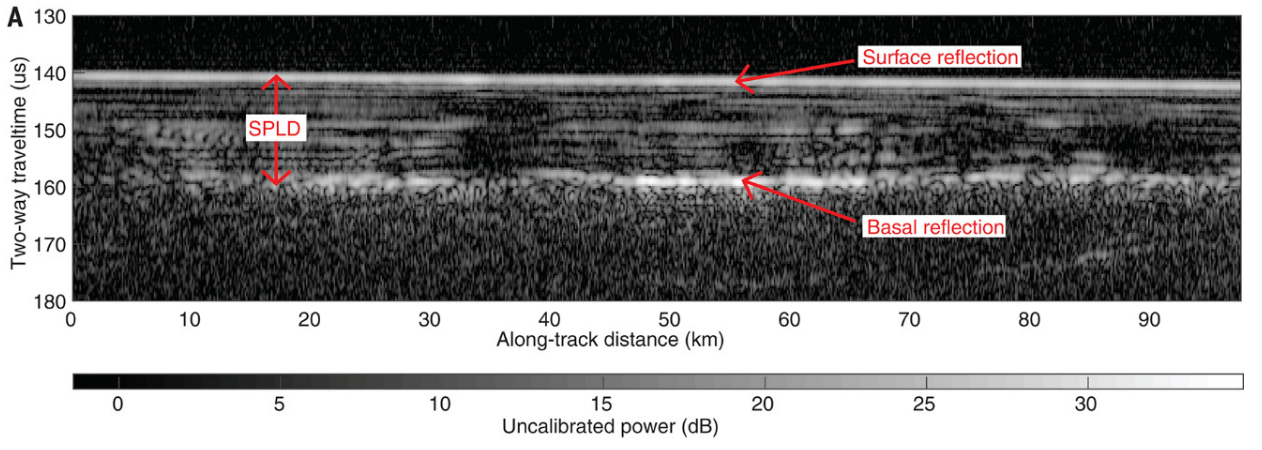
Figure 2: Volcanic ash from previous eruptions found within the Mýrdalsjökull ice. Figure from British Geological Survey (Katla volcano, 2019).

Next, Schmith et al. (2018) determined the extent of fragmentation at the time of the eruption. As magma rises to the surface, gasses dissolved in the magma begin to come out of dissolution and form bubbles. As the magma rises further the bubbles expand more and more until there are more bubbles than magma, resulting in fragmentation. When the bubbles all finally pop, an explosive eruption occurs. This process is similar to opening a shaken bottle of soda. When you open the bottle the pressure is decreased and bubbles begin to form. The bubbles degassing rapidly cause the soda to explode. By understanding the fragmentation process of the Katla volcano, geologists can infer past and future eruption sizes.

Finally they determined the water/magma interaction of glacial meltwater of the 1625  and 1755 eruptive events. To this end they examined the size and sorting of the ash grains. A decrease in grain size and increase in the sorting of ash indicates a decrease in the ash column height.  A decrease in grain size with a decrease in sorting of ash grains indicates increases in fragmentation intensity (Fig. 3).


Figure 3: Plots showing grain size base on median size (φ) in each unit vs. sorting. Figure adapted from Schmith et al., 2018.

Overall Schmith et al. (2018) found that both the 1625 and 1755 ash deposits were composed mainly of the two glasses, tachylite and sideromelane, followed by crystals and lithics (Fig. 4), which indicates that the eruptions were not water driven.

Schmith et al. (2018) found that 1625 CE eruption was a combination of magmatic degassing and water/magma interaction (phreatomagmatic) and  that the water/magma interaction generally decreased over the course of the eruption. However, toward the end of the eruption, the water/magma interaction became the larger driver of the eruption over fragmentation.

Figure 4: Components of ash fall deposits for the 1625 and 1755 Katla eruptions. Figure from Schmith et al. (2018).

The 1755 CE eruption was similar to the 1625 eruption in that it was both a result of fragmentation and of water/magma interaction. However, in the case of this eruption the water/magma interaction was only dominant at the beginning of the eruption, and fragmentation dominated most of this eruption.

By understanding how water from the glacier interacts with lava and superheated material, scientists can use the data from this study in order to help predict potential mechanisms for future Katla eruptions. This will allow insight into how far the ash from an eruption might travel, and the extent of lahar flows and flooding. Understanding the dynamics of Katla and the Mýrdalsjökull glacier allows governments to plan for hazards resulting from a Katla eruption and put protections in place to help keep the residents of Iceland and mainland Europe safe.

References

Katla’s Hazards Katla Volcano, http://katlavolcano.weebly.com/katlas-hazards.html (accessed March 2019).

Katla volcano, Iceland | Volcanology | Icelandic volcanism | Our research | British Geological Survey (BGS), https://www.bgs.ac.uk/research/volcanoes/katla.html (accessed March 2019).

Schmith, J., Höskuldsson, Á., Holm, P.M., and Larsen, G., 2018, Large explosive basaltic eruptions at Katla volcano, Iceland: Fragmentation, grain size and eruption dynamics: Journal of Volcanology and Geothermal Research, v. 354, p. 140–152, doi:10.1016/j.jvolgeores.2018.01.024.


Tuesday, March 5, 2019

Cool carbonate volcano in Africa, Ol Doinyo Lengai… No really, it’s cool!


Figure 1: The Arusha province of northern Tanzania is outlined in pink. White line through center is the border of Tanzania and Kenya. Ol Doinyo Lengai marked with yellow marker. Image courtesy of Google LandSat imagery (2018).

Ol Doinyo Lengai, or “Mountain of God”, is an active stratovolcano located along the East African Rift (EAR) in the Arusha volcanic province of northern Tanzania (Fig. 1 & 2). This volcano is unique in a few different ways: 1) it erupts carbonate material, rather than the usual silica rich material,  2) typical eruptions are extremely effusive, resembling black water more than lava flows; 3) the lavas are very cool compared to other lavas, at ~ 510℃ compared to 1171℃ at Kilauea; and 4) solidified lava weathers rapidly and turns white (Fig. 3).


Figure 2: Ol Doinyo Lengai volcano. Water stream in foreground. (By Clem23 - Own work, CC BY-SA 3.0)


For the past century Ol Doinyo Lengai has been erupting lavas that are uniquely poor in silicate minerals yet enriched in sodium, potassium, and rare earth elements (REE) such as rubidium, strontium, zirconium, niobium, thorium, and uranium. The most common type of lava on Earth today is basalt. Basalts typically contain 45 - 55% silica (SiO2). The carbonatite eruptions of Ol Doinyo Lengai contain <20% SiO2. So where is this cool, silica poor, REE-enriched lava coming from? This is a question scientists have been trying to answer since the discovery of this volcano. Mollex et al. (2018) may have new answers in their paper “Tracing helium isotope compositions from mantle source to fumaroles at Oldoinyo Lengai volcano, Tanzania.”

Figure 3: Satellite imagery of Ol Doinyo Lengai. The white is not snow. It is weathered carbonate material from previous eruptions. (Image courtesy of Google Maps satellite imagery.)

Helium has two stable isotopes: 3He and 4He. 3He was made during the Big Bang, and as the Earth formed it became incorporated into the mantle. 4He is a product of alpha decay of Uranium and Thorium. By studying the relative abundances of 3He and 4He in lavas, scientists can infer where the magma originates. In the Earth’s atmosphere  the ratio of 3He / 4He is 1.384 x 10⁻⁶, while crustral ratios are 0.4 to 1 x 10⁻⁸. The 3He / 4He ratios are typically reported relative to the atmospheric level as R/RA. In these units crustal rocks typically have 0.01 to 0.1 R/RA, and mantle rocks have 5 - 50 R/RA (Emsley, 2001) (Fig. 4). Mollex et al. (2018) sampled rocks, fumaroles, and cognate xenoliths1 in order to find the 3He/4He ratios of Old Doinyo Lengai.They found that the helium isotope compositions from cognate xenoliths at the summit of the volcano ranged from 5.79 ± 0.82 RA  to 7.24 ± 0.44 RA (Fig. 5). These ratios closely match those of more traditional silicic volcanoes of the surrounding Arusha volcanic province.


Figure 4: 3He/4He ratios found on Earth and in the solar system. Around 10-5 are Ocean Island Basalts (OIB), Mid-Ocean Ridge Basalts (MORB), and Island Arcs (Arcs). Figure 12.1 from White (2015).


Figure 5: Helium isotope ratios from previous studies (left) and the current study of Mollex et al., 2018 (right). RC / RA are helium isotope ratios corrected for atmospheric contamination. SCLM is Subcontinental Lithospheric Mantle (shallow mantle), and MORB is Mid-Ocean Ridge Basalt. The typical ratios of Typical 3He/ 4He ratios for SCLM are shown in orange (Gautheron & Moreira, 2002). And typical 3He/ 4He for MORB are shown in yellow (Graham, 2002). Gray circles denote uncorrected 3He/ 4He ratios. (R / RA). Figure 4 from Mollex et al. (2018).


Based on the helium isotopic ratios found in rocks and summit fumaroles on Ol Doinyo Lengai as well as other volcanoes in the Arusha volcanic province, Mollex et al. (2018) believe that the magma source may be the same for both. They propose that the magma source is old enriched sub-continental lithospheric mantle (SCLM) that has undergone compositional changes from fluids or a mid-ocean ridge basalt (MORB) type mantle magma that mixes with the Ol Doinyo Lengai magma chamber.


The research of Mollex et al. (2018) sheds more light on this enigmatic volcano but more work is required in order to fully understand what is happening in the complex magma system beneath Ol Doinyo Lengai.


References

Emsley, J., 2011, Natures building blocks: an A-Z guide to the elements: Oxford, Oxford University Press.

Mollex, G., Füri, E., Burnard, P., Zimmermann, L., Chazot, G., Kazimoto, E.O., Marty, B., and France, L., 2018, Tracing helium isotope compositions from mantle source to fumaroles at Oldoinyo Lengai volcano, Tanzania: Chemical Geology, v. 480, p. 66–74, doi:10.1016/j.chemgeo.2017.08.015.

White. W.M., 2015, Chapter 12 Noble Gas Isotope Geochemistry, in Isotope Geochemsitry, New York, Wiley-Blackwell, p. 418-452.

Wednesday, February 27, 2019

13 new acres of prime landslide derived beachfront property available now!

Figure 1: Map showing location of the Mud Creek slide. Before and after photos are present showing the spectacular movement of material. Also present are other similar landslides and instrumentation

Geologic time is slow. Very slow. When geologists talk about mountains rising, such as the Himalayas, they speak on the millimeter per year scale. Every so often, however, drastic movement occurs. On May 17th2017, the Mud Creek landslide occurred off of Highway 1 in Big Sur (fig.1). The slide was so large, it added 13 new acres to the coastline of California in an instant (fig. 2); amazingly, no one was injured. Since then, scientists have been able to research the slide to figure out how and why the slope failed so dramatically. 

Figure 2: Oblique time lapse view of the slope before failure, after, and the process of rebuilding the road.  

This event was what’s known as a bedrock landslide, which occur at large scales and often move very large, deep masses of earth. Bedrock landslides are highly dependent on groundwater rather than surface water. If the water table rises high enough into the soil that overlies the bedrock, it will effectively cause the overlying rock and soil to float. Water finds its way between individual grains and exerts a pressure on each grain, pushing them away from each other. This force destabilizes the rock, leading to rapid and catastrophic slope failure. 
It takes time for groundwater to move and cause the water table to rise. Groundwater flow isn’t like a raging river of water moving through the subsurface: in reality, groundwater saturates deeper rocks, sort of like a sponge, and only slowly creeps along if there is sufficient water pressure. Because of this, bedrock landslides can occur on seemingly innocuous, sunny days often months after a large rainfall event. In the case of the Mud Creek landslide, the last large rainfall events occurred in February, March, and April (fig. 3), but the slide didn’t occur until mid-May.

Figure 3: Hydrograph showing discharge of the Big Sur River. Discharge can be used as a proxy for rainfall events by looking for spikes in discharge. The landslide occurred in May when there was no rainfall occurring. 


 The Mud Creek landslide is interesting because it was actually moving steadily before the catastrophic slide occurred. Using remote sensing satellites, researchers were able to track the motion of the Mud Creek landslide for the past several years before the big slide occurred. Before total failure, the slope was moving at a stable rate, creeping along at about .24 to .43 m/yr (fig. 4). During this time (2009-2017), California was in a historic drought. Small rainfall events during the winters would cause the velocity of the slide to increase slightly, but it wasn’t until the historically wet winter of 2017 that the slide started to accelerate and deviate from past years’ motion (fig.4).
Researchers attribute the sudden catastrophic failure of the Mud Creek landslide to rapid changes in climate. The fast transition from a drought to very intense rain events caused the Mud Creek landslide to become unstable very quickly. Other similar, slow moving slides in the area remained stable, likely due to their smaller slope angles. 


Figure 4: Top: Downslope velocity of 3 creeping landslides. Notice rapid acceleration and subsequent failure of the Mud Creek slide. Bottom: Solid lines are precipitation values. The dotted line is the calculated pore fluid pressure. Notice how pore fluid pressure rapidly increases before the point of catastrophic failure.  

            California is currently experiencing another historically wet winter after a small drought, and Sierra snowpack currently stands at about 146% of what it was last year. What will this mean for catastrophic slope failure in California? If the Mud Creek landslide is any indication, it will likely mean more landslides during the spring months as snow melts and percolates through the subsurface. Keep a close eye on the coastal ranges of California this coming year and hopefully we’ll see some geology in action! 


Handwerger, A.L., Huang, M., Fielding, E.J., Booth, A.M., and Bürgmann, R., 2019, A shift from drought to extreme rainfall drives a stable landslide to catastrophic failure: Scientific Reports, p. 1–12, doi:10.1038/s41598-018-38300-0.

https://earthobservatory.nasa.gov/images/144552/a-strong-start-to-sierra-snowpack?utm_source=TWITTER&utm_medium=NASA&utm_campaign=NASASocial&linkId=63616203

Sunday, November 25, 2018

How lava flows on Olympus Mons tell us about the volcanic history of Mars

When we think about big mountains on Earth, the first thing that comes to mind is almost always Mt. Everest. Everest, however, is absolutely miniscule in comparison to the solar system’s largest volcano, Olympus Mons.


Standing at 21,229 meters above the Mars global datum (which can be thought of like sea level here on Earth), Olympus Mons is about two and half times as tall as Mount Everest. Unlike Everest, which is the result of two continental plates slamming into each other, Olympus Mons has a volcanic origin. It can be classified as a shield volcano, similar to those that make up the Hawaiian Islands.

Shield volcanoes are characterized by broad, gentle slopes (4-8 degrees) and tend to erupt nonviolently out of fissures on the flanks of the volcano (think the recent lava flows in Hawaii). The tops of shield volcanoes tend to have calderas, which are large collapsed structures found at the top of volcanoes. The magma in the chamber provides pressure that effectively holds up the top of the volcano.The magma chamber is literally inflating the top of the volcano, sustaining its dome-like shape. When the volcano is done erupting and the chamber is partially empty, the top of the volcano collapses and forms a caldera. Things can get a bit more complicated, however, as has been recently discovered at the caldera at the top of Olympus Mons.

Figure 1: The caldera atop Olympus Mons. Colors correspond to elevation, where warmer colors are higher and cooler colors are lower. The blue shapes extending outwards in almost all directions are lava flows. From Mouginis-Mark and Wilson (2019).

The caldera atop Olympus Mons, like the volcano itself, is huge. Its horizontal dimensions are 60 X 80 km, and it has a depth of about 3 km. Lava flows radiate outwards from the rim of the caldera (Fig.1). The strange thing about this caldera, however, is that some of these lava flows appear to flow uphill (Fig. 2). This is not normal, even on Mars. Lava can sometimes travel small distances uphill due to confining pressure or momentum. The lava flow on Olympus Mons, however, didn’t travel a short distance uphill -- it appears to have gone several kilometers!

Figure 2: Zoomed in from figure 1 to show the anomalous lava flow. The left and right images show the same lava flow. The left is CTX image of the flow and the right is an interpreted sketch of the flow with contour lines. The arrow denotes flow direction. Notice how the flow travels uphill. From Mouginis-Mark and Wilson (2019).

Scientists have instead interpreted this to mean that the lava flow was emplaced and flowed downhill normally, cooling as it did so. Later, new magma was brought up to the near surface through cracks in the rock in a sheet-like intrusion, called a dike. This dike caused a localized inflation to occur within the caldera which tilted certain areas. One of those areas was near the lava flow, making it appear to be flowing uphill. But why is this significant? This tilting shows scientists that volcanism didn’t end when previously thought, when the caldera collapse occurred. Instead, there must have been renewed volcanism closer to the present. By understanding the timing of volcanism on Mars, we can better understand Mars’s evolution as a planet, and therefore what past conditions on Mars could have been like. Was Mars more volcanic in its past? Could this volcanism provide a greenhouse effect to allow life to exist? This work takes us one step closer to fully answering these questions.


Original paper:
Mouginis-Mark, P. J., & Wilson, L. (2019). Late-stage intrusive activity at Olympus Mons, Mars: Summit inflation and giant dike formation. Icarus, 319(September 2018), 459–469. https://doi.org/https://doi.org/10.1016/j.icarus.2018.09.038


Tuesday, October 2, 2018

Buried liquid water on Mars?


The question of whether there is water on Mars has been hotly debated for decades. It has generally been proven that water exists on Mars, though it’s mostly trapped in its ice form. For life to exist as we know it, liquid water is a vital component. Because Mars has such a thin atmosphere, liquid water on the surface isn’t stable and will immediately boil off. This makes it very tricky to even begin to try to observe liquid water. Recently however, using radar instruments, Italian researchers have discovered evidence of a large, liquid water lake beneath the glaciers at the southern pole of Mars.

Aboard the EU’s Mars Express spacecraft is a special instrument called a radar sounder. Radar sounders work by shooting specific frequencies of radar pulses at the surface of a planet and then observing the reflected signal. This can be thought of like clapping in a cave and listening to the echo that comes back to you. Depending on what the echo “sounds” like, scientists can gain a wealth of information about whatever surface they aimed the instrument at. Differing frequencies used by the instrument contain information about the surface rock, ice, or even what lies beneath the surface.


Figure 1: Radargram of the subglacial lake. In this figure, the x-axis is horizontal distance on the planet, and the y-axis is the time is takes the radar signal to bounce back to the spacecraft, which can be interpreted to understand subsurface topography. This figure can be thought of as a cross section. The subglacial lake can be seen at the basal reflection label. The SPLD label shows the South Polar Layered Deposit, which is an area of the south pole where pure water ice is formed in layers. Figure 2A from Orosei et al. (2018).

Using a radar sounder named MARSIS, Italian scientists made several flybys of the south pole region, which is mostly covered in water-ice glacier year round. What they found were bright subsurface radar reflections where, ordinarily, there should be nothing (fig.1). When you shoot a radar wave at a material, the target’s atoms will react by becoming electrically polarized to varying degrees (the atoms will have one side become more positive than the other, or vice versa). This degree of polarization can be unique for different materials, so it’s a great way to identify materials hidden in the subsurface. This quality of materials is known as dielectric permittivity. By analyzing the MARSIS radar reflections, the scientists discovered that the dielectric permittivity of the anomalous reflection matched that of water-bearing materials. By making several flybys of the area, the scientists were able to map out the subglacial lake and found it to be about 20 km wide and approximately 1.5 km beneath the surface (fig.2) 
Figure 2: This image shows the estimated size of the lake. Radar tracks are colored depending on subsurface elevations with warmer colors corresponding to higher elevations and cooler corresponding to lower elevations. The perceived lake is marked by the bold, black line. Figure 3A from Orosei et al. (2018).

Does this confirm that there’s a subglacial lake at Mars south pole? It’s very likely. (SHARAD, another radar sounder orbiting Mars, didn’t see the lake, though this may be to due to the different set of frequencies SHARAD uses). Does this confirm that there’s life on Mars? Not yet. For all we know, the lake could be completely inhospitable, or might not even be there in the first place! What this study does provide is compelling evidence that the secrets to extraterrestrial life in our solar system might be hiding under some ice, just one planet away!


Orosei, R., Lauro, S. E., Pettinelli, E., Cicchetti, A., Coradini, M., Cosciotti, B., … Seu, R. (2018). Radar evidence of subglacial liquid water on Mars. Science, 361(6401), 490 LP-493. Retrieved from http://science.sciencemag.org/content/361/6401/490.abstract